
WallsHeaven makes decorative wall murals in high quality printing

412,453 East Europe Wall Murals - Canvas Prints - Stickers

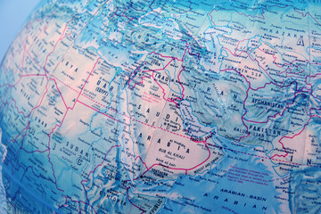
map detail globe eastern Europe
Globe of Each Continent
World map from space highlighting african continent, concept of satellite communication and technology
Abstract Digital Map of Europe, North Africa, and Middle East: Global Network and Connectivity
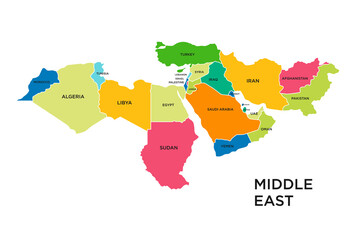
North Africa and Middle East political map with most important capitals and international borders. Maghreb, Mediterranean, West and Central Asian countries. Illustration with English labeling. Vector
Map of Eastern Europe. Handdrawn doodle style. Vector illustration
world map europe outline in vector
Detailed vector map of North - Central America, Asia Pacific, Europe, South America, Middle and East Africa Regions
Middle east country map vector
The world in the hands of finance, a businessman pointing East Europe, Ukraine, on earth globe map with index finger, showing continent resources, planning global business strategy
Gray Map of Europe
Gray Map of Europe
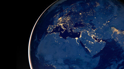
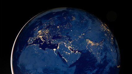
Earth photo at night, City Lights of Europe, Middle East, Turkey, Italy, Black Sea, Mediterrenian Sea from space, World map globe. Satellite HD photo. Elements of this image furnished by NASA.
Prague, view of the Vltava River and bridges
van transporting cargo model on urban city map. service delivery concept background
worldwide network digital background
europe countries map. map of the world by region. graphic design world map.
abstract digital map of europe africa middle east global network connectivity concept futuristic data visualization
European Union flag painted on tiled street floor and shadows group of people walking at sunny day.
East Europe on 3D map with flags
Machico is an old and charming town in the east of Madeira Island, Portugal
Easter eggs adorned with wax-resist dyeing method, known as Pysanky, displayed in a nest on a white wooden surface. The style is a traditional craft popular in Eastern European regions,
Old block of flats - apartment building made from concrete panels in communist era in eastern Europe, Prague, Czech Republic
World map from space highlighting african continent, concept of satellite communication and technology
Earth at night, city lights showing human activity in Europe and Middle East from space. Elements of this image furnished by NASA.
Aerial view old town, Tallinn, Estonia
Political map of Europe and Caucasian region in shades of gray on white background. Simple flat vector illustration.
Dotted world map. Blue vector illustration. World map vector, isolated on white background. Suitable for web site pattern, anual report, inphographics. Globe similar worldmap icon. Travel worldwide
Cozy Winter Polish Comfort Food Flat Lay
vector Europe high detailed political map. All elements detachable and labeled
Physical map of Europe, Greenland, Middle East and Asia, with high resolution details. Satellite view of Planet Earth. 3D illustration - Elements of this image furnished by NASA
Carte france et monde
vintage man young village black and white, eastern europe style, retro coat and boots
big waving national colorful flag of greece and national flag of philippines .
Abstract digital map showcasing Western Europe, North Africa, and the Middle East, representing the concept of global interconnectivity, business data exchange, cyber technology, information sharing,
World map. Silhouette map. Color modern vector map
Digital compass with world map
Europe, North Africa and Near East
Eastern Europe with embedded national flags on political 3D globe.
physical map of east asia china with high resolution details flattened satellite view of planet earth its geography and topography elements of this image furnished .illustration
futuristic digital map of europe africa and middle east global connectivity concept abstract illustration
3D Rendering of two flags from Republic of Armenia and Hungary together with fabric texture, bilateral relations, peace and conflict between countries, great for background
World map from space highlighting african continent, concept of satellite communication and technology
Panoramic view of Burgas city of Bulgaria, an important industrial, transport, cultural and tourist center
Main market square, Krakow, Poland
foggy day in Uzungöl - Uzungöl district, Çaykara - Trabzon, Turkey - The lake is situated south of the city of Trabzon in the Black Sea region of Turkey and a tourist magnet ... See More
Brasov, Romania - Winter Christmas Market in Transylvania
Europe map. 3d illustration of european countries map.
Administrative map of Ukraine as of February 2024.
a building with a large structure in the middle of a snowy field
Highly detailed Earth globe, Africa and Middle East. Png clipart isolated on transparent background
Europe with a part of the Middle East countries, political map. Western part of continent Eurasia, located in the Northern Hemisphere. Countries with international borders and English labeling. Vector
A blue and white world map with two airplanes flying over it. The map is filled with dots and lines, giving it a modern and abstract look. The airplanes are positioned at different heights and angles
Political map of Europe and Caucasian region in shades of green on white background. Simple flat vector illustration.
Earth photo at night, City Lights of Europe, Middle East, Turkey, Italy, Black Sea, Mediterrenian Sea from space, World map on dark globe on satellite HD photo.Elements of this image furnished by NASA
Europe Map with Illuminated Connections
Amazing View of Evangelical Cathedral and the Liars Bridge in the center of Sibiu city.
Hearty Autumn Polish Feast Flat Lay
View of Earth from space, showing the planet partially illuminated by sunlight with the night side visible. The continents of Africa, Europe, and parts of Asia and the Middle East are discernible
closeup of world globe focused on middle east with blue backgrou
Snapshot from Christmass dinner table, main subjects are traditional rolled wafers usually eaten with honey.
World map from space highlighting african continent, concept of satellite communication and technology
Delicious pierogies served in a rustic clay bowl with melted cheese and herbs, a traditional Eastern European dish
All Saints & St Nicolas church in Icklesham near Winchelsea, East Sussex, England
Golden gate of Long market decorated with Christmas illuminations at night, Gdansk, Poland.
colorful building of small fishing town seydisfjordur reflected in the calm waters of north atlantic ocean beautiful summer scene of east west iceland europe traveling concept background
World map. Silhouette map. Color modern vector map
Watercolor illustration frame of Easter elements, chickens, bunnies, eastern European folk style, vintage, muted colors, isolated clipart on white background, generative ai
Urban Environment Consisting Mainly of Concrete. Rusted Soviet Brutalist Structures in the Afternoon Gloom. Generative AI
Eastern Europe country Map. Map of Eastern Europe in set grey color
Mediterranean Basin, political map with different colored countries. The Mediterranean Sea and region with the countries of South Europe, North Africa and the Near East. Isolated illustration. Vector.
Berlin Wall course Map with Districts black and white
Man and black cats in snowy urban scene with brutalist architecture and car headlights
Planet Earth at night, city lights showing human activity in Europe and Middle East from space. Elements of this image furnished by NASA.
world map
world map
Network of interconnected cities and landmarks around the globe, with lines representing international trade routes and communication channels, generative AI
Planet earth photo at night on black background, City Lights of Africa, Europe, and the Middle East from space, World map at night, HD satellite image. Elements of this image furnished by NASA.
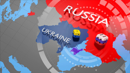
Map illustrations of Ukraine, Russia and neighboring countries
World map with names of countries and oceans. Travel agency concept
Ukraine crisis map. Ukraine and Russia military conflict. Geopolitical concept.
World map from space highlighting african continent, concept of satellite communication and technology
World map night lights. Continent africa, antarctic, asia, europe, america, australia vector detailed illustration
A colorful map of the world with a lot of dots and lines. The map is made up of different colors and shapes, and it looks like a computer-generated image. Scene is bright and lively
Old city center view in Krakow. Central market square in Wroclaw Poland with old colourful houses. Krakow Market Square from above, aerial view of old city center view in Krakow. Medieval city center.
futuristic digital map of europe africa and middle east global connectivity concept abstract illustration
Decorative or infographic topographic world map
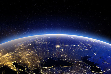
East Europe. Elements of this image furnished by NASA
Satellite Snapshot: A high-definition satellite photo showcases the Earth at night, with city lights
Aerial view of marina and blue waters of Brighton and Hove, East Sussex, UK
Europe vector high detailed political map in grey scales with regions borders and countries names. All elements separated in detachable layers
Ruins of 14th century Bodiam castle at sunrise. England
Panorama of Old Town of Gdansk, Dlugie Pobrzeze and Motlawa River at night, Poland


Why Wallsheaven is special?

30 Days on Returns

You can return or replace any product within 30 days without reason.

Free Express Delivery

Delivery is free for all of our products, wherever you are.

Eco Water-Based Inks

Our prints are odorless, ecological, and safe for children with vivid colors from natural dyes.

Simple Installation

Installing WallsHeaven's wallpaper mural is as easy as making paper airplane.

Artist Support

By choosing our photos, you will support the artists from all over the world.