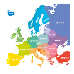
WallsHeaven makes decorative wall murals in high quality printing

697,783 Vector+geography+cartography Wall Murals - Canvas Prints - Stickers

Political World Map vector illustration isolated on white background with country names in german. Editable and clearly labeled layers.
View From Above Lie Of The Ground Conceptual Vector Topographic Map With Route And Coordinates Abstract Blue Background. Topography Landscape. Topography Geography. Topographic Map
Mountain hiking trail over terrain. Contour background geographic grid. Seamless vector topographic map background. Line topography map seamless pattern.
Karte von Montana
Alaska outline state of USA. Map in black and white color options. Vector Illustration..
Map of city streets, roads and towns. Map urban graphic background. City locations, pattern and plan for cartography, gps and travel. Vector. Illustration of cartography navigation. Geography design
Navigation icon set in flat style. Gps direction vector illustration on white isolated background. Locate pin position business concept.
Map of Indiana
vector map of italy with borders of regions
Medieval city, fantasy area map sketch. Mountain river and village buildings. Middle Ages map for board game. Hand drawn vector black line.
Topographic map seamless pattern vector background. Topographic contours. Dark seamless design. Uncommon tileable isolines pattern.
Louisiana state map. Map of the U.S. state of Louisiana.
map of the city of Madrid, Spain
Idaho Map Black | State Border | United States | US America | Transparent Isolated | Variations
Abstract topographic map background. Topo backdrop lines, contour, geographic grid
The stylized height of the topographic contour in lines and contours. Marine watershed. The concept of a conditional geography scheme and the water path. Vector illustration.
Topographic background and texture, monochrome image. 3D waves, White wave paper curved reliefs abstract background, Abstract topographic contours map background, Vector contour topographic map.
Blank map Brazil. High quality map Brazil with provinces on transparent background for your web site design, logo, app, UI. Stock vector. Vector illustration EPS10.
Map of United Arab Emirates. Abstract design, vector illustration by using adobe illustrator. UAE isolated map.
Dotted polka dot particle map of Africa. Vector Illustration. Light medical abstract concept for COVID-19 pandemic
World map infographic template. 3d isometric. Vector
Vector contour topographic map background. Topography and geography map grid abstract backdrop. Business concept. Vector striped illustration
World map vector grey isolated on white background. Flat Earth,  Globe world map icon. Travel worldwide eps 10
Map of South Korea
Simple Cartographic Map Logo Design Template
australia map icon, outline and silhouette of the australian continent
Map of the United States of America, Illustration.
Maryland County Map
Netherlands map vector. High detailed vector outline, blue silhouette and administrative divisions map of Netherlands. All isolated on white background. Vector illustratin
USA Map: Blank and Filled State Outlines for Graphic Design. USA Political Map Set - High Contrast and Outline Versions - Detailed States.
Black on white contours vector topography stylized height of the lines. The concept of a conditional geography scheme and the terrain path.
Japan map. Map of Japan in grey set
Iowa US Map. IA USA State Map. Black and White Iowan State Border Boundary Line Outline Geography Territory Shape Vector Illustration EPS Clipart
Tennessee Map Black | State Border | United States | US America | Transparent Isolated | Variations
Rich detailed vector map of Bradenton, Florida, USA
map of Panama. vector
Simple style compass symbol. Vector illustration EPS 10
The route of the Vasco da Gama expedition
Old world map flat vector illustration. Ancient parchment with countries and oceans names. Vintage document with continents, ships and wind rose drawings. Worldwide geography exploration.
Texas State Map Vector - Map of Texas State With County Boundaries Vector Illustration
Landform types vector illustration. Labeled geological educational scheme.
North Carolina Map vector illustration poster and flyer
Topographic map, paper cut style abstract background. Dark gray cover, banner, card curved layers and elevation contour lines. Dark color mountains, hills papercut art vector illustration
Map of Europe in colors of rainbow spectrum. With European countries names
Malaysia map vector illustration on white background. Map have all province and mark the capital city of Malaysia.
Tennessee black map on white background vector
Editable vector file of the counties making up the state of Maryland in the United States.
Marine compass map retro Rose Wind travel navigation black monochrome line vector illustration
USA map icon, outline style
orange india national map vector image on white background
Detailed USA Vector Map with State Boundaries in Blue. Detailed Political Map of the United States of America.
Trendy topography lines background. Colorful contour liens isolated on dark blue background.
Slovakia map. Blank vector map of the country. Borders of Slovakia for your infographic. Vector illustration.
Louisiana Map Black | State Border | United States | US America | Transparent Isolated | Variations
San Pedro Sula, Cortés, Honduras, bright outlined vector map
Uganda map silhouette line country Africa map illustration vector outline African isolated on white background
set of 3 maps of Slovenia - vector illustrations
Political blank World Map vector illustration with different colors for each continent and different tones for each country. Editable and clearly labeled layers.
vector map of the city of Milan, capital of Lombardy, Italy
The North Carolina counties map isolated on white background
Wind rose compass flat vector symbols set
Toulouse map vector poster flyer
Editable vector illustrated map of housing in a generic town
Simple United State white map on black background, vector, illustration
Topographic map lines background. Abstract vector illustration.
benelux map set isolated on white background.netherlands Luxembourg Belgium map
Color world map with the names of countries and national flags. Political map. Every country is isolated.
Janpanese map
Outline Illustration of the world (with country borders)
black silhouette country borders map of China on white background of vector illustration
Lake Garda (Italian Republic, Italy) map vector illustration, scribble sketch Lago di Garda map
Urban vector city map of Philadelphia, Pennsylvania, United States of America
Geodesic Tools Isometric Composition
syria map silhouette with transparent background
Bregenz, Austria bright vector map
World map isolated on white background. for website layouts, background, education, precise, customizable, Travel worldwide, map silhouette backdrop, earth geography, political, reports.
vector map of spain with borders of regions
Blank USA Map vector illustration isolated on white background. Editable and clearly labeled layers.
Abstract background wavy topographic line contour geography map. Seamless pattern and banner design. Modern and dynamic feel to topographic mapping vector illustration.
The Michigan State County Map with labels
Compass wind rose hand drawn vector design element
Florida map vector poster flyer
Globe Icon Set - Round World Map Vector Flat
Philippines map vector illustration on white background. Map have all province and mark the capital city of Philippines.
European Union countries. English labeling. Political map with borders and country names. 28 EU members, colored in light blue. Political and economic union in Europe. Illustration over white. Vector.
Norway municipalities high detailed vector map colored by administrative regions (counties). All municipalities and capital cities are named. Flag of Norway
map of the city of Albuquerque, USA
Gold world map illustration isolated on a white background
Terrain map. Contours trails, image grid geographic relief topographic contour line maps cartography texture, vector illustration
Blank map of Canada. High quality map of  Canada with provinces on transparent background for your web site design, logo, app, UI. America. EPS10.
Symbols and drawings for a school geography lesson, set on a white background. Hand drawn vector doodle line illustration. Globe, world map, animals, signs, schemes. Design of cover, banner.
Australia map in green color
High detailed vector map - Ohio.
Hatched map of world. Striped design vector illustration on white background.
A highly detailed, fictional topographic vector map complete with various symbols.
USA map outline. United States vector blank map. US line map template
set of 3 maps of Armenia - vector illustrations
germany map - High detailed blue map with counties/regions/states of germany. nepal map isolated on transparent background.
Canada gray map with provinces. Vector illustration.
Indiana administrative maps


Why Wallsheaven is special?

30 Days on Returns

You can return or replace any product within 30 days without reason.

Free Express Delivery

Delivery is free for all of our products, wherever you are.

Eco Water-Based Inks

Our prints are odorless, ecological, and safe for children with vivid colors from natural dyes.

Simple Installation

Installing WallsHeaven's wallpaper mural is as easy as making paper airplane.

Artist Support

By choosing our photos, you will support the artists from all over the world.