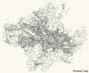
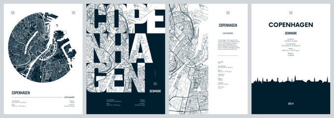
WallsHeaven makes decorative wall murals in high quality printing

117,170 Town+map+capital Wall Murals - Canvas Prints - Stickers

Ohio - Highly detailed editable political map with labeling.
Urban vector city map of Cheyenne, USA. Wyoming state capital
Black and white map of Columbus city. Ohio Roads
North Carolina - vector - state of USA
Greater London map showing Haringey borough in blue. 3D Rendering
Republic of the Gambia - vector map
City map of Prague
City map of Prague
Administrative vector map of the Canadian capital Quebec, Canada
Administrative and political map of the Catalan capital of Barcelona with flag
Area map of Seoul, South Korea
Alberta province administrative map
Map Oklahoma City. Oklahoma Roads
Street map art of Honolulu city in USA - United States of America - America
Urban vector city map of St Paul, USA. Minnesota state capital
Uzbekistan map vector illustration on white background. Map have all province and mark the capital city of Uzbekistan.
Road map around Paris
Old color map of South America
maine administrative and political vector map with flag
Illustration of a world map in shades of green, showing country names, State names (USA & Australia), capital cities, major lakes and oceans. Print at no less than 36
Illustration of a world map in shades of green, showing country names, State names (USA & Australia), capital cities, major lakes and oceans. Print at no less than 36". Jpeg no need for vector program
Blue and White vector city map of London with well organized separated layers.
The Maritimes region of Eastern Canada, also called Maritime provinces, gray political map, with capitals, borders and large cities. The provinces New Brunswick, Nova Scotia, and Prince Edward Island.
Editable template of map of Guyana with marks. Guyana  on world map and on South America map.
Editable template of map of Guyana with marks. Guyana on world map and on South America map.
Europe map - green hue colored on dark background. High detailed political map of european continent with country, capital, ocean and sea names labeling
Vector black map of San Francisco
Detailed navigation urban street roads map on vintage beige background of the Italian regional capital city of Florence, Italy
The United States of America - vector map
South America map
South America map
Area map of Kuala Lumpur, Malaysia
Belgrade in Serbia pinned on colorful political map of Europe. Geopolitical school atlas. Tilt shift effect.
Map of New York city
set of political maps of Denmark with regions and flag map isolated on white background
Paris city map
Paris city map
St Lucia map vector illustration on white background. Map have all province and mark the capital city of St Lucia.
Black and white map of Denver city. Colorado Roads
World map grey and white with cities and countries Vector illustration
Berlin-Brandenburg Metropolitan Region Map
Colourful Illustration of a world map showing country names, State names (USA & Australia), capital cities, major lakes and oceans. Print at no less than 36
Colourful Illustration of a world map showing country names, State names (USA & Australia), capital cities, major lakes and oceans. Print at no less than 36". Jpeg - no need for vector program
Rome color map
Rome color map
Australia, political map, with the capital Canberra, internal administrative boundaries, and most important cities. Officially the Commonwealth of Australia, a sovereign country. Illustration. Vector.
Vector map of Finland. Country map with division, cities and capital Helsinki. Political map,  world map, infographic elements.
Vector map of Finland. Country map with division, cities and capital Helsinki. Political map, world map, infographic elements.
Little Rock city map, capital of the USA state of Arkansas. Municipal administrative black and white area map with rivers and roads, parks and railways.
Edinburgh
Edinburgh
Scandinavian countries map with capital cities skylines icons. Vector illustration
Seoul city map with roads and streets, South Korea. Vector outline illustration.
High detailed Ohio road map with labeling.
Area map of Shenzhen, China
design art light black white map city  Leeds
design art light black white map city Leeds
Mecklenburg-Vorpommern administrative map
Vector vintage map of San Francisco
Hawaii Green map 3d concept background.
Urban vector city map of Hartford, USA. Connecticut state capital
Tanzania map vector illustration on white background. Map have all province and mark the capital city of Tanzania.
Map of Warsaw and its districts
power of japan, energy beam on tokyo. dark map with illuminated cities and human density areas. 3d illustration
Japan, Tokyo - capital city, pinned on political map
administrative vector map of the US American State of Georgia
Saudi Arabia - detailed map with administrative divisions country.
Satellite view of Seoul. South Korea. Map o the capital, streets and building. Seoul Capital Area
Kuwait political map with capital Kuwait City, national borders, important cities and rivers. English labeling and scaling. Illustration.
Map Columbus city. Ohio Roads
Beautiful British Columbia Map. Canada. White shape of BC province with highways and tourist destinations marked. Touristic guide.
Ladakh map District map of Ladakh. Ladakh map with district and capital. Colour full district map of Ladakh.
USA map with state borders, capitals and names of states. Editable vector illustration isolated on white background.
High detailed Virginia physical map with labeling.
Set of travel posters with Copenhagen, detailed urban street plan city map, Silhouette city skyline, vector artwork
Highly detailed Bangladesh map with flag, capital and small map of the world
Vector modern illustration. Simplified geographical  map of Australia and nearest areas (Indonesia, Papua New Guinea and etc). Blue background of Indian ocean and seas. Names of Australian cities
Vector modern illustration. Simplified geographical map of Australia and nearest areas (Indonesia, Papua New Guinea and etc). Blue background of Indian ocean and seas. Names of Australian cities
Paris vintage map
Paris vintage map
Africa map with countries and capital cities
Urban vector city map of Richmond, USA. Virginia state capital
Austria map vector illustration on white background. Map have all province and mark the capital city of Austria.
Illustrated map of Bern, Switzerland.
Mexico State region location within Mexico 3d map
Egypt, Cairo - capital city, pinned on political map
providence road and neighborhood map
Vienna map poster, administrative area plan view. Black, white and blue detailed design.
Stockholm Map. vector map of major city in the Sweden.
Arizona political map with capital Phoenix, important cities, rivers, lakes. State in southwestern region of United States, Part of Western and Mountain States. English labeling. Illustration. Vector.
Wisconsin - vector map
Street map art of San Diego city in USA - United States of America - America
Abruzzo Map. State and district map of Abruzzo. Administrative map of Abruzzo with district and capital in white color.
Warsaw, Masovian, Poland (POL) - Urban vector city map with parks, rail and roads, highways, minimalist town plan design poster, city center, downtown, transit network, gradient blueprint
el salvador
el salvador
High detailed Tennessee physical map with labeling.
Сity map Berline, color detailed urban road plan, vector illustration
Nepal map on white background vector
Detailed white map of USA with cities and towns
Paris vintage map
Paris vintage map
Road map of Florida, US American federal state. Editable highly detailed Floridian transportation map with highways and interstate roads, rivers and cities realistic vector illustration
Urban vector city map of Colombia, USA. South Carolina state capital
Nicaragua map vector illustration on white background. Map have all province and mark the capital city of Nicaragua.
3D Rendering white city, Cityscape with building house and street with shallow depth of field effect
3d isometric map of Santiago is a city of Chile
New jersey map with capital city


Why Wallsheaven is special?

30 Days on Returns

You can return or replace any product within 30 days without reason.

Free Express Delivery

Delivery is free for all of our products, wherever you are.

Eco Water-Based Inks

Our prints are odorless, ecological, and safe for children with vivid colors from natural dyes.

Simple Installation

Installing WallsHeaven's wallpaper mural is as easy as making paper airplane.

Artist Support

By choosing our photos, you will support the artists from all over the world.