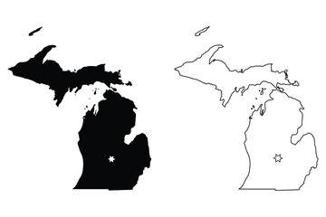
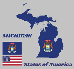
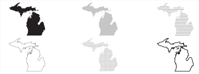
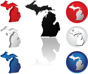
WallsHeaven makes decorative wall murals in high quality printing

4,777 Outline+michigan+state Wall Murals - Canvas Prints - Stickers

Michigan administrative map, Michigan outline and counties state map set - illustration version
Detroit skyline, monochrome silhouette. Vector illustration.
geographic vector Map of the U.S. state of Wisconsin
Michigan map on blue USA map
Dish of pasta with parmesan cheese shaped as Michigan.(series)
A minimalist black-and-white state map of Florida showing major roads and coastlines
Retro US city map of Fennville, Michigan. Vintage street map.
United States of America map and infographic of provinces, political maps of United States of America, earth tone color - Vector File
North America vector map. Usa canada mexico world map icon, american continent
Usa map. Infographic us map with multi-colored states and pins, topographic info outline road, travel poster vector illustration
illustration with the drawing of a Glacial Lake
Gray map of Michigan, federal state of USA. Silhouette of Michigan abstract outline editable map with borders and flag of federal state realistic vector illustration
Cityscape Building Line art Vector Illustration design - Lexington city
Map of Michigan (USA)
Brazil map vector outline with scales of miles and kilometers in gray background
Iowa Map. Political map of Iowa with boundaries in Outline.
Minnesota, Wisconsin, Michigan,Iowa, Illinois USA state outline
Ontario Province Map
Lansing skyline. Colorful linear style. Editable vector file.
Vector illustration of Chicago City, horizontal poster with line art design illuminated chicago city scape, panoramic contemporary concept with decorative font for word chicago on dark background.
Colorful hand drawn vector map of the USA
Michigan MI state Map USA with Capital City Star at Lansing. Black silhouette and outline isolated on a white background. EPS Vector
United States of America map with neon glowing light. Creative animation of America, shiny outline USA map.
A minimalist black-and-white state map of Florida showing major roads and coastlines
Midland Michigan. US street map with black and white lines.
Illinois state. United States of America. Postcard from Chicago and Springfield. Travel vector
Vector Map of the U.S. state of Wisconsin
michigan - usa
michigan - usa
Mappa satellitare di Detroit, Michigan, Stati Uniti. Strade della città. Stradario e mappa del centro città
Layered editable vector illustration of map outlines of ten US cities
Michigan
Michigan
United States of America Regions Map
united states of america
France, map vector outline with scales of miles and kilometers in gray background
Iowa Map. Political map of Iowa with boundaries in white color.
white detroit skyline silhouette on black background
State of Illinois political map
Chicago skyline silhouette in colorful geometric style. Symbol for your design. Vector illustration.
States of America territory on grey background
map of the United States
Michigan state highlighted in blue on 3D map of the United States
A minimalist black-and-white state map of Florida showing major roads and coastlines
Royal Oak Michigan. US street map with black and white lines.
Colorful political USA map
illinois road map with flag
michigan - usa
michigan - usa
map of the U.S. state of Michigan
Map outline and flag of Michigan and the state name. State coat of arms on a dark blue field. The state of America.
American isolated vector icon. Country map shape. Isolated white background. American patriotic background.
Detailed map of the United States, including Alaska and Hawaii. United States with each state abbreviation
lake Michigan vector
Mexico map vector outline with scales of miles and kilometers in gray background
Iowa Map. Political map of Iowa with boundaries in white color.
Vector map of New York. High detailed illustration. Country of the United States of America. Flat style. Vector
Michigan blank outline map set
Grand Rapids skyline silhouette in colorful geometric style. Symbol for your design. Vector illustration.
United States and Mexico political map of administrative divisions. Blank black outline vector map
Chicago Skyline Outline Sketch
Abstract High Detailed Glow Blue Map on Dark Background of Map of Michigan symbol for your web site design map logo, app, Travel. Vector illustration eps 10.
Blue Map of US federal state of Michigan
A minimalist black-and-white state map of Florida showing major roads and coastlines
Retro US city map of Ann Arbor, Michigan. Vintage street map.
Map of North America, isolated on white background. Vector EPS.10
Vector map of agricultural resource regions, United States
Michigan State Map Black. Michigan map silhouette isolated on transparent background. Vector Illustration. Variants.
United States and Canada flag ripped paper grunge background. Abstract United States and Canada economics, politics conflicts, war concept texture background
Detroit Michigan Map, Detailed Dark Map of Detroit Michigan
Highly detailed three dimensional map of USA with regions border. United States of America.
LGBT Flag inside the State of Michigan
Corona virus outbreak hot spots on USA map
Louisiana Map. State and district map of Louisiana. Political map of Louisiana with outline and black and white design.
Map of the United States of America with state names. The borders of each state is colored with USA flag colors. Artwork design. Vector isolated on white.
michigan state outline on white background
USA state map. Michigan outline symbol. Easily editable vector illustration on a transparent background.
Colorful North America map
Vector illustration of Chicago City, horizontal monochrome poster with line art design chicago city scape, urban american concept with unique decorative font for black word chicago on white background
Usa map. Infographic us map with states and pins, topographic info outline road, travel poster vote vector election president
A minimalist black-and-white state map of Florida showing major roads and coastlines
Oxford Michigan. US street map with black and white lines.
United States Of America Country Map With Surrounding Border
Outline Detroit skyline. Trendy template with Detroit city buildings and landmarks in line style. Stock vector design.
State of Michigan Icons
Map of North America, isolated on white background. Vector EPS10
A blue and purple map of the United States
Doodle vector map of Michigan state of USA.
Cityscape Building Line art Vector Illustration design - huntsville city
United States of America map. All states silhouettes with titles. Black and outline. Vector EPS 10
United States map with corona-virus outbreak hot spots
New Mexico Map. State and district map of New Mexico. Political map of New Mexico with outline and black and white design.
High detailed black map of USA with states borders


Why Wallsheaven is special?

30 Days on Returns

You can return or replace any product within 30 days without reason.

Free Express Delivery

Delivery is free for all of our products, wherever you are.

Eco Water-Based Inks

Our prints are odorless, ecological, and safe for children with vivid colors from natural dyes.

Simple Installation

Installing WallsHeaven's wallpaper mural is as easy as making paper airplane.

Artist Support

By choosing our photos, you will support the artists from all over the world.