WallsHeaven makes decorative wall murals in high quality printing

4,777 Outline+michigan+state Wall Murals - Canvas Prints - Stickers

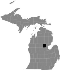
Map of Roscommon County in Michigan state on white background. single County map highlighted by black colour on Michigan map. UNITED STATES, US
Map of missaukee County in Michigan state on white background. single County map highlighted by black colour on Michigan map. UNITED STATES, US
Map of luce County in Michigan state on white background. single County map highlighted by black colour on Michigan map. UNITED STATES, US
Map of Macomb County in Michigan state on white background. single County map highlighted by black colour on Michigan map. UNITED STATES, US
Map of allegan County in Michigan state on white background. single County map highlighted by black colour on Michigan map. UNITED STATES, US
Map of gogebic County in Michigan state on white background. single County map highlighted by black colour on Michigan map. UNITED STATES, US
Map of Wayne County in Michigan state on white background. single County map highlighted by black colour on Michigan map. UNITED STATES, US
Map of Mackinac County in Michigan state on white background. single County map highlighted by black colour on Michigan map. UNITED STATES, US
Map of Alger County in Michigan state on white background. single County map highlighted by black colour on Michigan map. UNITED STATES, US
Van Buren County, Michigan (U.S. county, United States of America, USA, U.S., US) map vector illustration, scribble sketch Van Buren map
Delta County, Michigan (U.S. county, United States of America, USA, U.S., US) map vector illustration, scribble sketch Delta map
Map of Ottawa County in Michigan state on white background. single County map highlighted by black colour on Michigan map. UNITED STATES, US
Map of Ingham County in Michigan state on white background. single County map highlighted by black colour on Michigan map. UNITED STATES, US
Map of leelanau County in Michigan state on white background. single County map highlighted by black colour on Michigan map. UNITED STATES, US
Map of Barry County in Michigan state on white background. single County map highlighted by black colour on Michigan map. UNITED STATES, US
Map of Monroe County in Michigan state on white background. single County map highlighted by black colour on Michigan map. UNITED STATES, US
Map of Livingston County in Michigan state on white background. single County map highlighted by black colour on Michigan map. UNITED STATES, US
Map of Calhoun County in Michigan state on white background. single County map highlighted by black colour on Michigan map. UNITED STATES, US
Map of Jackson County in Michigan state on white background. single County map highlighted by black colour on Michigan map. UNITED STATES, US
Map of branch County in Michigan state on white background. single County map highlighted by black colour on Michigan map. UNITED STATES, US
Map of Dickinson County in Michigan state on white background. single County map highlighted by black colour on Michigan map. UNITED STATES, US
Sanilac County, Michigan (U.S. county, United States of America, USA, U.S., US) map vector illustration, scribble sketch Sanilac map
Map of cheboygan County in Michigan state on white background. single County map highlighted by black colour on Michigan map. UNITED STATES, US
Map of Chippewa County in Michigan state on white background. single County map highlighted by black colour on Michigan map. UNITED STATES, US
Map of berrien County in Michigan state on white background. single County map highlighted by black colour on Michigan map. UNITED STATES, US
Map of Emmet County in Michigan state on white background. single County map highlighted by black colour on Michigan map. UNITED STATES, US
Map of presque Isle County in Michigan state on white background. single County map highlighted by black colour on Michigan map. UNITED STATES, US
Map of gladwin County in Michigan state on white background. single County map highlighted by black colour on Michigan map. UNITED STATES, US
Lansing City, Michigan (United States cities, United States of America, usa city) map vector illustration, scribble sketch City of Lansing map
Map of ogemaw County in Michigan state on white background. single County map highlighted by black colour on Michigan map. UNITED STATES, US
Map of Kalamazoo County in Michigan state on white background. single County map highlighted by black colour on Michigan map. UNITED STATES, US
Map of Mason County in Michigan state on white background. single County map highlighted by black colour on Michigan map. UNITED STATES, US
Map of ontonagon County in Michigan state on white background. single County map highlighted by black colour on Michigan map. UNITED STATES, US
Dickinson County, Michigan (U.S. county, United States of America, USA, U.S., US) map vector illustration, scribble sketch Dickinson map
Map of benzie County in Michigan state on white background. single County map highlighted by black colour on Michigan map. UNITED STATES, US
Map of delta County in Michigan state on white background. single County map highlighted by black colour on Michigan map. UNITED STATES, US
Allegan County, Michigan (U.S. county, United States of America, USA, U.S., US) map vector illustration, scribble sketch Allegan map
Chippewa County, Michigan (U.S. county, United States of America, USA, U.S., US) map vector illustration, scribble sketch Chippewa map
Antrim County, Michigan (U.S. county, United States of America, USA, U.S., US) map vector illustration, scribble sketch Antrim map
Michigan map in yellow color
Reese Michigan. US street map with black and white lines.
Grand Rapids Michigan. US street map with black and white lines.
Schoolcraft County, Michigan (U.S. county, United States of America, USA, U.S., US) map vector illustration, scribble sketch Schoolcraft map
Zeeland Michigan. US street map with black and white lines.
Retro US city map of Kent City, Michigan. Vintage street map.
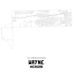
Wayne Michigan. US street map with black and white lines.
Wolverine Michigan. US street map with black and white lines.
Retro US city map of Dearborn, Michigan. Vintage street map.
Troy Michigan. US street map with black and white lines.
Lansing City, Michigan (United States cities, United States of America, usa city) map vector illustration, scribble sketch City of Lansing map
Retro US city map of Ypsilanti, Michigan. Vintage street map.
Sidnaw Michigan. US street map with black and white lines.
Burr Oak Michigan. US street map with black and white lines.
Hart Michigan. US street map with black and white lines.
Detroit city (United States of America, USA, U.S., US, United States cities, usa city)- map is designed rainbow abstract colorful pattern, City of Detroit map made of color explosion,
Mackinaw City Michigan. US street map with black and white lines.
Ann Arbor Michigan. US street map with black and white lines.
Keweenaw County, Michigan (U.S. county, United States of America, USA, U.S., US) map vector illustration, scribble sketch Keweenaw map
Tuscola County, Michigan (U.S. county, United States of America, USA, U.S., US) map vector illustration, scribble sketch Tuscola map
Calhoun, Crawford, Cass, Clinton, Clare and Branch County, Michigan (U.S. county, United States of America, USA, U.S., US) map vector illustration, scribble sketch map
Edenville Michigan. US street map with black and white lines.
Charlevoix County, Michigan (U.S. county, United States of America, USA, U.S., US) map vector illustration, scribble sketch Charlevoix map
Delta County, Michigan (U.S. county, United States of America, USA, U.S., US) map vector illustration, scribble sketch Delta map
Emmet County, Michigan (U.S. county, United States of America, USA, U.S., US) map vector illustration, scribble sketch Emmet map
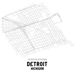
Detroit Michigan. US street map with black and white lines.
Antrim County, Michigan (U.S. county, United States of America, USA, U.S., US) map vector illustration, scribble sketch Antrim map
Ann Arbor Michigan. US street map with black and white lines.
Black highlighted location map of the Kalkaska County inside gray map of the Federal State of Michigan, USA
Clio Michigan. US street map with black and white lines.
Black highlighted location map of the Gladwin County inside gray map of the Federal State of Michigan, USA
Iron County, Michigan (U.S. county, United States of America, USA, U.S., US) map vector illustration, scribble sketch Iron map
Pontiac Michigan. US street map with black and white lines.
Charlevoix County, Michigan (U.S. county, United States of America, USA, U.S., US) map vector illustration, scribble sketch Charlevoix map
United States of America Map. Illustration.
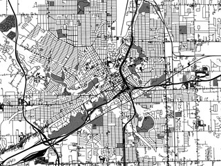
Greyscale vector city map of  Flint Michigan in the United States of America with with water, fields and parks, and roads on a white background.
Greyscale vector city map of Flint Michigan in the United States of America with with water, fields and parks, and roads on a white background.
Baraga County, Michigan (U.S. county, United States of America, USA, U.S., US) map vector illustration, scribble sketch Baraga map
Michigan map collection. Borders of Michigan for your infographic. Colored us state regions. Vector illustration.
United States of America Map. Illustration.
1:1 square aspect ratio vector road map of the city of  Jackson Michigan in the United States of America with black roads on a white background.
1:1 square aspect ratio vector road map of the city of Jackson Michigan in the United States of America with black roads on a white background.
United States of America Map. Illustration.
Black highlighted location map of the Tuscola County inside gray map of the Federal State of Michigan, USA
Alpena County, Michigan (U.S. county, United States of America, USA, U.S., US) map vector illustration, scribble sketch Alpena map
Shape of Michigan, polygonal sunburst. Map of the us state with colorful star rays. Michigan illustration in digital, technology, internet, network style. Vector illustration.
Saint Louis Michigan. US street map with black and white lines.
Ingham, Ionia, Isabella and Roscommon County, Michigan (U.S. county, United States of America, USA, U.S., US) map vector illustration, scribble sketch map
Pontiac Michigan. US street map with black and white lines.
Caro Michigan. US street map with black and white lines.
Retro US city map of Glen Arbor, Michigan. Vintage street map.
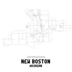
New Boston Michigan. US street map with black and white lines.
Holland Michigan. US street map with black and white lines.
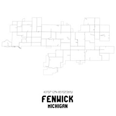
Fenwick Michigan. US street map with black and white lines.
Huron County, Michigan (U.S. county, United States of America, USA, U.S., US) map vector illustration, scribble sketch Huron map
Oden Michigan. US street map with black and white lines.
Michigan low poly sunburst set. Logo of us state in geometric polygonal style. Vector illustration.
Network map of Michigan. Us state digital connections map. Technology, internet, network, telecommunication concept. Vector illustration.
Retro US city map of Rockwood, Michigan. Vintage street map.
States of America territory on grey background
Retro US city map of River Rouge, Michigan. Vintage street map.
Fair Haven Michigan. US street map with black and white lines.


Why Wallsheaven is special?

30 Days on Returns

You can return or replace any product within 30 days without reason.

Free Express Delivery

Delivery is free for all of our products, wherever you are.

Eco Water-Based Inks

Our prints are odorless, ecological, and safe for children with vivid colors from natural dyes.

Simple Installation

Installing WallsHeaven's wallpaper mural is as easy as making paper airplane.

Artist Support

By choosing our photos, you will support the artists from all over the world.