WallsHeaven makes decorative wall murals in high quality printing

5,330 Michigan+map+outline Wall Murals - Canvas Prints - Stickers

Michigan shaped from golden glitter on black (series)
All 50 USA States Map Pixel Perfect Icons (Filled Style). Vector icons of the complete United States of America states map.
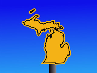
Michigan warning sign
Empty vector map of Lansing, Michigan, USA
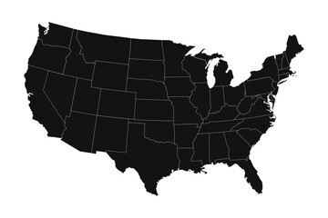
High detailed black map of USA with states borders
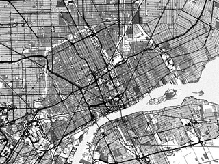
1:1 square aspect ratio vector road map of the city of  Detroit Michigan in the United States of America with white roads on a black background.
1:1 square aspect ratio vector road map of the city of Detroit Michigan in the United States of America with white roads on a black background.
All U.S. states map shapes USA borders
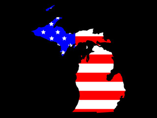
outline drawing of michigan state map on usa flag.
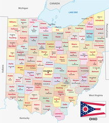
Ohio administrative and political vector map with flag
United States of America map and infographic of provinces, political maps of United States of America, earth tone color - Vector File
Map of the United States with Oregon highlight
Political map of United States od America, USA. Simple flat black outline vector map with black state name labels on white background.
south carolina map
south carolina map
North America map with country. USA, Canada, Mexico maps.Poster map of America with regions names.  Outline North America map isolated on white background. Vector illustration
North America map with country. USA, Canada, Mexico maps.Poster map of America with regions names. Outline North America map isolated on white background. Vector illustration
Travel poster, urban street plan city map Chicago and Detroit, vector illustration
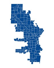
Outline blue map of Milwaukee city
Vector Blue Wave Pattern Map of All the Great Lakes of North America. Wavy Line Pattern Silhouette of the 5 Great Lakes
Bloomfield Hills Michigan. US street map with black and white lines.
Michigan Map. Political map of Michigan with boundaries in Outline.
Michigan network map. Abstract polygonal US state map design. Internet connections vector illustration.
Vector illustration map of the USA
Vector color map of Indiana state. Usa
state of michigan
state of michigan
Empty vector map of Grand Rapids, Michigan, USA
Michigan state circle map with long shadow
Greyscale vector city map of  Detroit Michigan in the United States of America with with water, fields and parks, and roads on a white background.
Greyscale vector city map of Detroit Michigan in the United States of America with with water, fields and parks, and roads on a white background.
Sticker Map Chicago city. Illinois Roads
Vector map of Isle Royale National Park in Lake Superior, Michigan, USA
United States of America map. USA map. Flat black and white vector illustration. American map for poster, banner, t-shirt. Design USA cartography map.
State Silhouette Collection
USA modern minimalistic map
Map of USA
Map of USA
outline drawing of michigan state map on usa flag.
Highly detailed vector silhouettes of US state maps, Division United States into counties, political and geographic subdivisions, The Great Lakes region - Minnesota, Wisconsin,  Michigan - set 5 of 17
Highly detailed vector silhouettes of US state maps, Division United States into counties, political and geographic subdivisions, The Great Lakes region - Minnesota, Wisconsin, Michigan - set 5 of 17
Map of North America. World map concept. Colored flat vector illustration isolated.
Map of the USA in gray on a white background
Blueprint US city map of Bay City, Michigan.
Image relative to USA travel. Michigan state map textured by lines and dots pattern
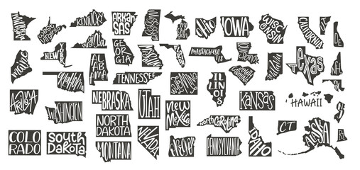
Michigan, Nebraska, Nevada, New Mexico state names distorted into state outlines. Pop art style vector illustration for stickers, t-shirts, posters and social media.
Vector illustration map of the USA
Ohio state detailed editable map with cities and towns, geographic sites, roads, railways, interstates and U.S. highways. Vector EPS-10 file, trending color scheme
state of michigan
state of michigan
Isolated states of United States of America map. Detailed vector illustration.
usa map. usa political map. vector map of us states named.
vector map of United States with indication of Michigan
Michigan Map. State and district map of Michigan. Political map of Michigan with outline and black and white design.
Michigan city line icon. Element of USA states illustration icons. Signs, symbols can be used for web, logo, mobile app, UI, UX
lake michigan drainage basin vector map
USA state set of text map for print design. Vector graphic design. Typography map. Icon vector. Vintage modern poster typography. USA state name. United States of America with text state names
USA vector map with Massachusetts map prominent.
Michigan USA Map Flag. MI US Outline Boundary Border Shape State Flag Sign Symbol Atlas Geography Banner. Michiganian Transparent PNG Flattened JPG Flat JPEG
Low Poly Map of Michigan State (USA). Polygonal Shape Vector Illustration.
outline drawing of michigan state map on usa flag.
Pin map of the United state of America. Vector illustration isolated on white background
Michigan US state hand drawn pencil sketch outline map with heart shape. Continuous line drawing of patriotic home sign. A love for a small homeland. T-shirt print idea. Vector illustration.
vector map of the city of Detroit, Michigan, USA
Charlevoix Michigan. US street map with black and white lines.
Usa map. Outline silhouette of united states of america. Simple line borders of us. Flat american map with california, hawaii, texas, washington, florida, michigan, virginia and other state. Vector
Outline map of the United States of America. 50 States of the USA. US map with state borders. Silhouette of the USA and flag. Vector
Wayne County (Michigan) outline map set
Detailed vintage map of United States of America with names of 50 states, vector illustration
Map of Michigan with flag
State of Illinois political map
United States and Mexico political map of administrative divisions. Black outline vector map with labels.
indiana road map
indiana road map
michigan county map
michigan county map
simple ohio state map
illinois road map with flag
wisconsin road map
wisconsin road map
Vector map of agricultural resource regions, United States
illinois road map
illinois road map
Retro US city map of Mackinaw City, Michigan. Vintage street map.
Blueprint US city map of Mackinaw City, Michigan.
Manistee Michigan. US street map with black and white lines.
Portage Michigan. US street map with black and white lines.
Retro US city map of Sterling Heights, Michigan. Vintage street map.
Blueprint US city map of Saint Ignace, Michigan.
lake erie drainage basin vector map
Sandusky Michigan. US street map with black and white lines.
Retro US city map of Marshall, Michigan. Vintage street map.
Ortonville Michigan. US street map with black and white lines.
Blueprint US city map of Long Lake, Michigan.
Flint Michigan. US street map with black and white lines.
Information vector map of Lake Huron in North America
wyoming administrative map
Retro US city map of Holland, Michigan. Vintage street map.
Vector Map of the U.S. state of Wisconsin
South Lyon Michigan. US street map with black and white lines.
ohio road map
ohio road map
Retro US city map of South Haven, Michigan. Vintage street map.
Retro US city map of Saint Joseph, Michigan. Vintage street map.
Retro US city map of Muskegon, Michigan. Vintage street map.
Minnesota State map highlighted on USA map. Minnesota map on United state of America.
Retro US city map of Dearborn, Michigan. Vintage street map.
Saugatuck Michigan. US street map with black and white lines.
Oakland Michigan. US street map with black and white lines.
Retro US city map of Charlotte, Michigan. Vintage street map.
Midland Michigan. US street map with black and white lines.
Milford Michigan. US street map with black and white lines.


Why Wallsheaven is special?

30 Days on Returns

You can return or replace any product within 30 days without reason.

Free Express Delivery

Delivery is free for all of our products, wherever you are.

Eco Water-Based Inks

Our prints are odorless, ecological, and safe for children with vivid colors from natural dyes.

Simple Installation

Installing WallsHeaven's wallpaper mural is as easy as making paper airplane.

Artist Support

By choosing our photos, you will support the artists from all over the world.