
WallsHeaven makes decorative wall murals in high quality printing

2,152 District Outline Michigan Wall Murals - Canvas Prints - Stickers

Michigan administrative map, Michigan outline and counties state map set - illustration version
Michigan outline map
Baraga County (Michigan) blank outline map
Outline of Michigan
Outline of Michigan
An urban vector city map of Detroit, Michigan, outlines its streets and highlights local landmarks..
Map of the US states with districts. Map of the U.S. state of Michigan
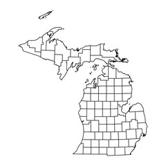
Vector outline map of Michigan state divided into counties
Michigan state map with counties borders and colored congressional districts boundaries due to The 2020 United States census and which is valid since 2023. Flag of Michigan. Vector
map of the united states with each state colored in different vibrant colors
United States Map Eps, All 50 States Outline USA Map Eps, Commercial Digital Eps Instant Download for Cricut or Silhouette
Michigan state of USA. Michigan territory. States of America territory on white background. Separate states. Vector illustration
White solid outline of the state of Michigan
Michigan US Map. MI USA State Map. Black and White Michigander State Border Boundary Line Outline Geography Territory Shape Vector Illustration EPS Clipart
High detailed Michigan road map with labeling.
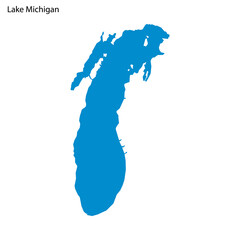
Blue outline map of Michigan Lake, Isolated vector siilhouette
Leelanau County, Michigan (U.S. county, United States of America, USA, U.S., US) map vector illustration, scribble sketch Leelanau map
Michigan map shape, united states of america. Flat concept icon symbol vector illustration
Illinois state map. Map of the U.S. state of Illinois.
Michigan state map, USA. Set of Michigan maps with outline border, counties and US states map. Black and white color.
Detroit city map with roads and streets, United States. Vector outline illustration.
Map of lenawee County in Michigan state on white background. single County map highlighted by black colour on Michigan map. UNITED STATES, US
United States and Canada political map of administrative divisions. Blank black outline vector map
Emmet County (Michigan) blank outline map
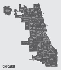
Chicago City administrative map
usa map with states, georgia, vector illustration
The vibrant neon outline of the United States maps is set against a dark background to symbolize energy and connection across the nation
USA region silhouettes set and blank map of the country isolated on white background. Vector illustration design
Map of the US states with districts. Map of the U.S. state of Wisconsin,Michigan
Michigan state map with counties. Vector illustration.
Contour map of the state of Michigan, USA. Vector graphic illustration on a transparent background with black region borders
Midwest region. East North Central: Illinois, Indiana, Michigan, Ohio,Wisconsin. States of America territory. Separate states. Vector illustration
Black solid map of the state of Michigan
HD City view , drone view from above
Michigan road and highway map. Vector illustration.
3d isometric map East North Central Region of United States
Michigan Map. District map of Iowa in 2020. District map of Michigan in color with capital.
Michigan map shape, united states of america. Flat concept icon symbol vector illustration
Michigan state map of regions districts vector black on white and outline
Lake Erie (Canada, United States, North America, us, Great Lakes) map vector illustration, scribble sketch map
America Michigan vector map.Hand drawn minimalism style.
Michigan administrative map. counties map of Michigan, blank Map, empty map of Michigan
United States Map Eps, All 50 States Outline USA Map Eps, Commercial Digital Eps Instant Download for Cricut or Silhouette
Mackinac, Macomb, Manistee, Marquette outline maps
Michigan state map shape with flag. PNG icon
Modern Dynamic White Map of Michigan with Counties
The vibrant neon outline of the United States maps is set against a dark background to symbolize energy and connection across the nation
Michigan state map, USA. Set of Michigan maps with outline border, counties and US states map. Black and white color.
Illinois state map. Map of the U.S. state of Illinois.
Michigan state of United States of America, USA. Simplified thick black outline map with rounded corners. Simple flat vector illustration
Abstract - High Detailed Copper Map of Michigan. Vector illustration eps10.
Michigan state of USA. Michigan flag and territory. States of America territory on white background. Separate states. Vector illustration
Gray solid map of the state of Michigan
Editable vector file of the counties that make up the state of Michigan, located in the United States.
Map of Michigan state from dots
map of Michigan state of United States and location on USA map
Michigan counties map and congressional districts since 2023 map. Lansing (state's capital city), Detroit and Grand Rapids (state's most populous cities) skylines. Vector set
Set of Michigan map, united states of america. Flat concept icon vector illustration
map of the united states with each state colored in different vibrant colors
Lake Superior (Canada, United States, North America, us, Great Lakes) map vector illustration, scribble sketch map
Highly Detailed Michigan Blind Map.
High detailed illustration map - outline Michigan State Map
United States Map Eps, All 50 States Outline USA Map Eps, Commercial Digital Eps Instant Download for Cricut or Silhouette
Schoolcraft County (Michigan) blank outline map
Michigan State Flag Map Illustration
Mount Pleasant Michigan. US street map with black and white lines.
The skyscrapers of downtown Chicago which is a view from the river.
Michigan Map. State and district map of Michigan. Political map of Michigan with outline and black and white design.
Clear and detailed map of a village barber shop, using thick and thin black lines on a pure white base.
Grey Map of the United States and Russia with simple, clear outlines, perfect for both print and digital use.set of maps.
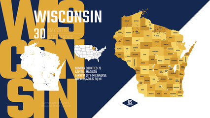
30 of 50 states of the United States, divided into counties with territory nicknames, Detailed vector Wisconsin Map with name and date admitted to the Union, travel poster and postcard
Michigan state of USA. Michigan flag and territory. States of America territory on white background. Separate states. Vector illustration
Transparent Outline Maps of All US States Including District of Columbia and Territories in High-Resolution Vector Format
Map of Michigan Vector Design Template
map of the U.S. state Michigan
Michigan 3d map state of United States Template for your design
Map Of Michigan 3d Shape
Michigan map shape, united states of america. Flat concept icon symbol vector illustration
michigan
michigan
Lake Michigan (United States, North America, us, Great Lakes) map vector illustration, scribble sketch map
Michigan - Highly detailed editable political map with labeling.
Map of Alger County in Michigan state on white background. single County map highlighted by black colour on Michigan map. UNITED STATES, US
Vector poster background of the US state of Michigan, with name, map, state flag, borders, nickname, order number and date of admission to the Union, capital, area. Illustration 22 of a series of 50.
Muskegon, Newaygo, Oakland, Oceana outline maps
Map the State of Michigan in gray on a white background
Map of Michigan
Map of Michigan
The skyscrapers of downtown Chicago which is a view from the river.
Chicago City administrative maps
Electoral college map of the United States
Michigan state map with counties. Vector illustration.
Vector posters states of the United States with a name, nickname, date admitted to the Union, The Great Lakes region - Minnesota, Wisconsin,  Michigan - set 5 of 17
Vector posters states of the United States with a name, nickname, date admitted to the Union, The Great Lakes region - Minnesota, Wisconsin, Michigan - set 5 of 17
Michigan state of USA. Michigan flag and territory. States of America territory on white background. Separate states. Vector illustration
Michigan State Map Black. Michigan map silhouette isolated on transparent background. Vector Illustration. Variants.
Abstract Map of the State Michigan (US) showing the territory with a pattern of black squares like a chessboard
Abstract - High Detailed Silver Map of Michigan. Vector illustration eps10.
Outline of Michigan map with bridge, The silhouette of an American state.
Mount Pleasant Michigan. US street map with black and white lines.
Set of Michigan map, united states of america. Flat concept icon vector illustration
Michigan Map. State and district map of Michigan.
Alcona County, Michigan (U.S. county, United States of America, USA, U.S., US) map vector illustration, scribble sketch Alcona map
High detailed Michigan road map with labeling.
5 10 15 20


Why Wallsheaven is special?

30 Days on Returns

You can return or replace any product within 30 days without reason.

Free Express Delivery

Delivery is free for all of our products, wherever you are.

Eco Water-Based Inks

Our prints are odorless, ecological, and safe for children with vivid colors from natural dyes.

Simple Installation

Installing WallsHeaven's wallpaper mural is as easy as making paper airplane.

Artist Support

By choosing our photos, you will support the artists from all over the world.