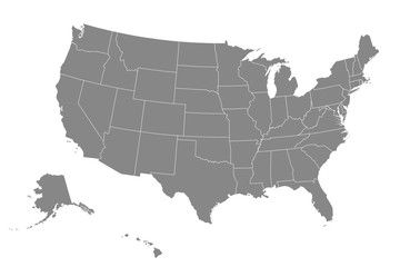
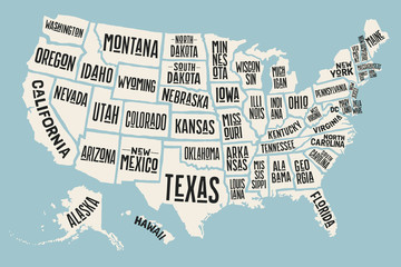
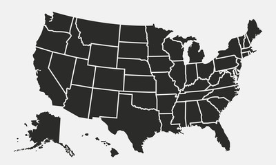
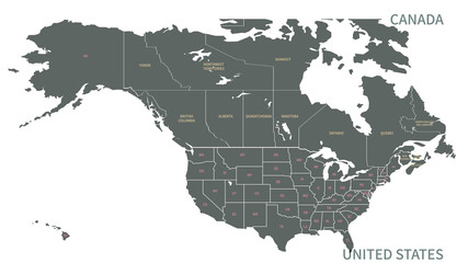
WallsHeaven makes decorative wall murals in high quality printing

544,390 Design Nation Map Wall Murals - Canvas Prints - Stickers

Grey map of United States of America on white background. Vector illustration eps 10
USA map. Vector illustration.
Poster map of United States of America with state names. Print map of USA for t-shirt, poster or geographic themes. Hand-drawn colorful map with states. Vector Illustration
USA map with states isolated on a white background. United States of America map. Vector illustration
Jordan national or independence day banner for country celebration. Flag and map of Jordan modern retro design with typorgaphy abstract geometric icons. Vector illustration.
United States of America map . Modern simple line style . Vector .
Hand drawn black map of Thailand. Silhouette, South East Asia geography. Vector isolated on white background
Spain region map
Spain region map
japan vector map in solid style
North American Countries Map. 
The main boundary map of Canada, the United States.
North American Countries Map. The main boundary map of Canada, the United States.
map of china
map of china
New Jersey Map Black | State Border | United States | US America | Transparent Isolated | Variations
Pennsylvania administrative map, Pennsylvania outline and counties state map set - illustration version
Dot USA map. Dotted America map in flat design. US halftone pattern, isolated vector
Switzerland map vector. High detailed vector outline, blue silhouette and administrative divisions map of Switzerland. All isolated on white background. Template for website, design, cover.
Maryland County Map
Maryland County Map
USA Map Black Silhouette
Blank outline map of USA
Detailed world map with borders of states. Isolated world map. Isolated on white background. Vector illustration
United States of America map
High resolution map of the world (without Antarctica) split into individual countries. Showing distinct borders between countries. Robinson projection.
California State outline contour silhouette map
Poster map of United States of America with state names. Black and white print map of USA for t-shirt, poster or geographic themes. Hand-drawn black map with states. Vector Illustration
United States of America blank map with states isolated on a white background. USA map background. Vector illustration
Florida map shape, united states of america. Flat concept icon symbol vector illustration
India map.States and union territories of India. India's political map with the capital New Delhi, national borders, important cities, rivers and lakes and Hindi labelling with details. Hindi Map.
Hand drawn black map of Kerala, Indian state. Silhouette, geography. Vector isolated on white background
High detailed map of Antigua and Barbuda. Outline map of Antigua and Barbuda. North America
USA states map outline. Country map United States of America. US states borders silhouettes.
black halftone dotted world map illustration vector
High Quality map of Bangalore is a city of India, with borders of the regions. Map of Bangalore for your web site design, app, UI. EPS10.
Pennsylvania Map Black | State Border | United States | US America | Transparent Isolated | Variations
A digital indian flag on the map on a computer screen, displaying location markers and illustrating the interconnected relationship.  india independence day
A digital indian flag on the map on a computer screen, displaying location markers and illustrating the interconnected relationship. india independence day
China map isolated on white background. for website layouts, background, education, precise, customizable, Travel worldwide, map silhouette backdrop, earth geography, political, reports.
Super High detail of USA map. Outline map of America on white background. Vector Illustration.
Switzerland cantons map
Spain map black on white background vector
Guam State Map Black. Guam map silhouette isolated on transparent background. Vector Illustration. Variants.
Simple (only sharp corners) map of Canada vector drawing. Mercator projection. Filled and outline version.
Urban vector city map of Madison, USA. Wisconsin state capital
Wyoming state gray maps. Vector illustration.
Celebrate World Africa Day with an illustration featuring the iconic map of Africa
italy map isolated silhouette
Rajasthan map illustration
Indonesia detailed Bali map shape, Flat web graphic concept icon symbol vector illustration
World map (AI generated)
World map made up of dots. Vector illustration
Vector usa map america icon. United state america country world map illustration
hole in paper
hole in paper
map of southeast asia countries with dotted style
Pennsylvania administrative map, Pennsylvania outline and counties state map set - illustration version
Illinois Map Black | State Border | United States | US America | Transparent Isolated | Variations
North America map templates. USA, Canada and Mexico map isolated on white background. North America maps set. Vector illustration
map of
map of
Abstract globe design focusing on Asia prominently.
Turkmenistan silhouette map
Greece or the Hellenic Republic holiday banner with Greek national flag, country map and Athens landmark silhouettes. Modern retro design with minimalist geometric shapes
White solid outline of the state of Montana
Illinois black map on white background vector
World map.
World map.
Belgium map with provinces. Vector illustration.
USA Map. Poster map of United States of America. Print of USA with name states, poster or geographic, political theme. Infographic graphic design print map of USA states. Vector Illustration
3D rendering of world map
China map. Map of China in white set
Vector isolated illustration of simplified administrative map of Mexico (United Mexican States). Borders of the provinces (regions). Grey silhouettes. White outline
A map of a country highlighting areas where neural tech has been implemented in governing processes showing how it has improved efficiency and outcomes for citizens..
Set of Palestine map isolated on white background, vector illustration design
Simple (only sharp corners) map of Ireland (whole island, including northern British part) vector drawing. Mercator projection. Filled and outline version.
set of 3 maps of Italy - vector illustrations
British Virgin Islands
USA states map outline. Country map United States of America. US states borders silhouettes.
Abstract map of Qatar with hexagon lines
India map and flag design vector icon set. Black Outline vector Map of India with regions EPS 10
Map of Greece
Map of Greece
Puerto Rico map
Puerto Rico map
Nevada Map Black | State Border | United States | US America | Transparent Isolated | Variations
A map of the Indian subcontinent with the Indian flag
Puerto Rico black map on white background vector
usa map icon
usa map icon
Colombia map with administrative divisions.
AUSTRALIA MAP COLOR WITH REGIONS flat design illustration vector
Discover the essence of Africa with a captivating map
American Samoa map
American Samoa map
USA All States Map, 50 States, USA state map silhouettes,  perfect for map design, educational material, travel content. Distinct, easily identifiable states
USA All States Map, 50 States, USA state map silhouettes, perfect for map design, educational material, travel content. Distinct, easily identifiable states
Rajasthan map illustration
USA tourist map with famous landmarks and state names.
Florida Map Vector Icon Set. Miami state cutout map vector symbol for Ui Designs.
vector illustration of gray colored world map
Map of United States of America, states outlined and colored


Why Wallsheaven is special?

30 Days on Returns

You can return or replace any product within 30 days without reason.

Free Express Delivery

Delivery is free for all of our products, wherever you are.

Eco Water-Based Inks

Our prints are odorless, ecological, and safe for children with vivid colors from natural dyes.

Simple Installation

Installing WallsHeaven's wallpaper mural is as easy as making paper airplane.

Artist Support

By choosing our photos, you will support the artists from all over the world.