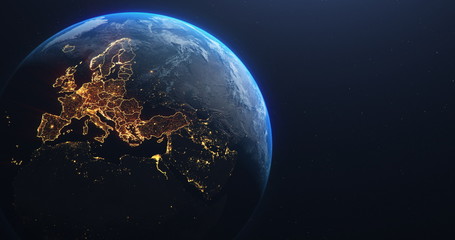
WallsHeaven makes decorative wall murals in high quality printing

7,963 Continent+cartography+europa Wall Murals - Canvas Prints - Stickers

Hiszpania mapa europa
Illustration d'une carte du Bahrein
Map of Germany
Map of Germany
Bike dot illustration1
Planet Earth from Space EU Europe Countries highlighted, elements of this image courtesy of NASA

Grey world map with borders of states. Isolated world map on white background. Vector illustration.
Description Map of European Countries with vector
World Map Globe with shadow on a Isolated background - stock vector.
World Map Seperate Countries
World map formed by dots. Dotted earth map.
City lights Australia
Abstract Digital Europe Map
World map dots random size black EPS 10
World Map - High Detailed Vector (Beschriftung Deutsch)
Etude de l'Islande
Etude de l'Islande
Europe vector map
Europe vector map
Globus mit alle Kontinenten Vektor Illustration isoliert auf weißem Hintergrund
Colorful political map World continents.
statistic map
statistic map
Mapa mundi,globo terraqueo en diferentes colores
Vector World Map - Africa, America, Asia, Europe and Oceania

Abstract gray blank world map.
Hong Kong map vector poster flyer
Car dot illustration1
Planet Earth from Space European Union Countries highlighted orange glow, 2020 political borders and counties, city lights, 3d illustration, elements of this image courtesy of NASA
Grey world map isolated on white background. World vector illustration
3 versions of Hong Kong map city vector by thin black outline simplicity style, Black dot style and Dark shadow style. All in the white background.
Mapa actual azul de la Unión Europea.
Colorful Vector map of Europe
europe
europe
City lights North America
Ireland Irlandia mapa europy
World map with Europe magnified by loupe
Blue world map globe isolated on white background
Carte de la Russie verte
Set of transparent globes of Earth, realistic world map in globe shape with transparent texture and shadow
City Lights from Above
Colorful political map World continents.
Perspectives Terrestres : Une Cartographie Globale en 3D, où les Continents Émergent des Océans Bleus. Entre Affaires et Environnement, une Vision Abstraite de notre Planète, où le Vert de la Nature s
Europe - Political Map of Europe
A world map isolated. Watercolor. White background. Generative AI
World map with all countries. white background
Globus
Globus
Europa mit Grenzen in leuchtend grau
Planet Earth from Space EU Europe Countries highlighted, elements of this image courtesy of NASA
Grey world map isolated on white background. World vector illustration
Euprope
Euprope
Mapa azul de Europa.
world globe
world globe
European global network and connectivity, paper art
World map for kids with cute animals cartoon planes and air balloons. Children's map design for wallpaper, kid's room, wall art. America, Europa, Asia, Africa, Australia, Arctica. illustration.

Grey world map with borders of states. Isolated world map on white background. Vector illustration.

Grey world map with borders of states. Isolated world map on white background. Vector illustration.
Grey world map isolated on white background. World vector illustration

Grey world map with borders of states. Isolated world map on white background. Vector illustration.

Grey world map with borders of states. Isolated world map on white background. Vector illustration.

Grey world map with borders of states. Isolated world map on white background. Vector illustration.

Grey world map with borders of states. Isolated world map on white background. Vector illustration.

Grey world map with borders of states. Isolated world map on white background. Vector illustration.

Grey world map with borders of states. Isolated world map on white background. Vector illustration.

Grey world map with borders of states. Isolated world map on white background. Vector illustration.
Grey world map isolated on white background. World vector illustration

Grey world map with borders of states. Isolated world map on white background. Vector illustration.

Grey world map with borders of states. Isolated world map on white background. Vector illustration.

Grey world map with borders of states. Isolated world map on white background. Vector illustration.

Grey world map with borders of states. Isolated world map on white background. Vector illustration.

Grey world map with borders of states. Isolated world map on white background. Vector illustration.

Grey world map with borders of states. Isolated world map on white background. Vector illustration.

Grey world map with borders of states. Isolated world map on white background. Vector illustration.

Grey world map with borders of states. Isolated world map on white background. Vector illustration.

Grey world map with borders of states. Isolated world map on white background. Vector illustration.
Grey world map isolated on white background. World vector illustration

Grey world map with borders of states. Isolated world map on white background. Vector illustration.

Grey world map with borders of states. Isolated world map on white background. Vector illustration.
Grey world map isolated on white background. World vector illustration

Grey world map with borders of states. Isolated world map on white background. Vector illustration.
Grey world map isolated on white background. World vector illustration
World map dots square random size
World map countries with Africa magnified by loupe
Carte de l'Autriche (Drapeau)
Earth continent silhouettes
North America Map with magnifying loupe
World map with North America magnified by loupe
Planet Earth from Space European Union Countries highlighted teal glow, 2020 political borders and counties, city lights, 3d illustration, elements of this image courtesy of NASA
Colorful political map World continents.
blue world map globe isolated on white background. Focus Asia and Australia
Asia Map with magnifying loupe
Europe map - brown orange hue colored on dark background. High detailed political map of european continent with country, ocean and sea names labeling


Why Wallsheaven is special?

30 Days on Returns

You can return or replace any product within 30 days without reason.

Free Express Delivery

Delivery is free for all of our products, wherever you are.

Eco Water-Based Inks

Our prints are odorless, ecological, and safe for children with vivid colors from natural dyes.

Simple Installation

Installing WallsHeaven's wallpaper mural is as easy as making paper airplane.

Artist Support

By choosing our photos, you will support the artists from all over the world.