



WallsHeaven makes decorative wall murals in high quality printing

9,926 City Network Border Wall Murals - Canvas Prints - Stickers

Digital Map of Africa with Illuminated Cities
Europe at Night: A Digital Map of Connectivity
Abstract digital map of the Middle East, concept of  global network and connectivity, data transfer and cyber technology, information exchange and telecommunication
Abstract digital map of the Middle East, concept of global network and connectivity, data transfer and cyber technology, information exchange and telecommunication
San Jose California Map, Detailed Map of San Jose California
Cadastre Map And City Building Survey
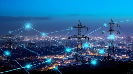
A stunning view of illuminated cityscape at night with power lines and digital connections showcasing energy distribution.
A detailed, futuristic digital map of the continental United States illuminated with interconnected blue lights highlighting various regions and nodes.
blue illuminated map of india connect to other countries
Hand holding mobile phone screen mockup template on city bokeh lights
Minimalist monitoring platform and prison fence
Europe at Night: A Glowing Constellation
Glowing blue dots connected by lines forming a network on a global map, symbolizing international connections,
Location icon over world map, specific region highlighted, 3D illustration
Global network connection depicted in red lights across a world map on a dark background.
ai, network, technology, artificial intelligence, energy, innovation, future, digital, link, tech. smart cityscape with neon border builder. futuristic communication technology concept and innovation.
global network concept with lines connecting various cities on Earth at night viewed from space telecommunications and internet connection technology
ai, network, technology, artificial intelligence, energy, innovation, future, digital, link, tech. smart cityscape with neon border builder. futuristic communication technology concept and innovation.
geofencing technology in urban areas for marketing and security miniature city model concept 3d illustration
3d isometric landmark map design of the Istanbul city turkey
Illustration of global trade and transport network with map and airplanes.
Location services with GPS satellite signal for smartphone ads modern illustration of geofencing technology and online communication.
Europe Network, Digital Connections
Abstract digital map of the Middle East, concept of  global network and connectivity, data transfer and cyber technology, information exchange and telecommunication
Abstract digital map of the Middle East, concept of global network and connectivity, data transfer and cyber technology, information exchange and telecommunication
Richmond Virginia Map, Detailed Map of Richmond Virginia
Aerial view of Wisconsin city's urban landscape, showcasing intricate road network, parks, and lakes, with vibrant
World map with glowing city connections, symbolizing global business exchange
Aerial view of a city map with gray streets and buildings, overlaid with a subtle grid pattern, conveying a sense of urban planning and navigation.
Cadastre Map And City Building Survey
A global shipping network map with highlighted routes and connections
Digital world map with network connections
Boxes with people in them. AIG535
Night city street with large blank billboard illuminated, surrounded by light trails creating a dynamic, modern urban feel.
A global network of interconnected devices secured by AI-driven encryption protocols, enabling secure communication and data transfer across borders and industries
A jetliner is seen from the front as it challenges the vastness of space and connectivity, surrounded by digital lights above a bustling planet.
Glowing digital map of Europe,
Blurred Boundaries: Transforming Traditional Desks into Futuristic Work Environments, Overlay layers with city background and holograms of technology icons are in the foreground, intersected by
Intricate global value chains connecting manufacturers, suppliers, and distributors across borders - conceptual illustration of international trade and supply chains
global network concept with lines connecting various cities on Earth at night viewed from telecommunications and internet connection technology featuring an Earth globe
Black world map with city lights on white background. Global business and travel concept
A futuristic digital world map with glowing city lights and borders
Location services with GPS satellite signal for smartphone ads modern illustration of geofencing technology and online communication.
Global network connection with glowing city lights and lines.
Nighttime Satellite View of Earth with Illuminated City Lights
Dallas Texas Map, Detailed Map of Dallas Texas
 A Zilliqa logo on a blue background, with sharding technology circuits, the emblem glows in white and blue, floating above a scalable blockchain network, bordered by a dark blue frame
A Zilliqa logo on a blue background, with sharding technology circuits, the emblem glows in white and blue, floating above a scalable blockchain network, bordered by a dark blue frame
Digital grid with intersecting blue lines and glowing nodes
Aerial View of City Map with Orange Location Pins at Night Signifying Urban Navigation
Cadastre Map And City Building Survey
blue illuminated map of india
A nighttime satellite view of Europe, showing the illuminated cities and borders of the continent
Europe digital map with glowing network and city highlights
Global skyline merging iconic landmarks from different continents, futuristic design with vibrant lighting, world cities, cultural fusion
mini black flowers theme border and blue background website banner
World map with glowing city lights at night
Glowing world map on dark background, representing global connectivity.
Location services with GPS satellite signal for smartphone ads modern illustration of geofencing technology and online communication.
This image showcases the Earth's surface at night, highlighting a global network with bright connections representing connectivity around the world.
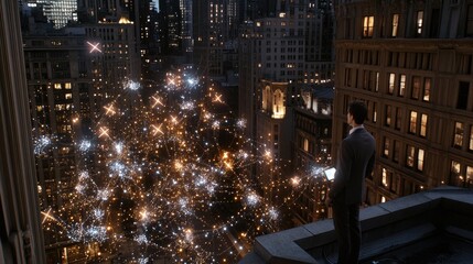
A businessman stands on a rooftop at night, gazing at floating images linked by glowing lines that connect cities across borders
Sparkling Night View of Europe. European Union Concept With Illuminated Cities. 3D Illustration.
Illuminated World Map with Glowing Cities and Connections
Stunning night view of Earth from space with illuminated city lights, glowing orange network, and vibrant atmospheric details highlighting urban areas
A digital map of the world with glowing connections between cities, representing global connectivity and data transfer across borders in an internet network concept
Illuminated Western Europe Map with City Lights and Borders
Cleveland Ohio Map, Detailed Map of Cleveland Ohio
A global shipping network map with highlighted routes and connections
A white light rail train travels along a smooth highway, bordered by trees, in the bustling city of Shenzhen, showcasing the harmony of urban transit and nature
Glowing Blue Digital Map Of Africa With Glowing Dots And Lines
Digital World Map with Glowing Data Points and Network
Intricate global value chains connecting manufacturers, suppliers, and distributors across borders - conceptual illustration of international trade and supply chains
A vibrant, colorful representation of a digital map showcasing city infrastructure with glowing neon lines and points.
Glowing Map of Europe with Cities and Borders
Digital grid with intersecting blue lines and glowing nodes
A colorful 3D map with location markers highlighting different areas in an urban city, featuring rivers and buildings.
Global cities network connections map with glowing digital lines
Illuminated earth from space showing detailed city lights and connected lines representing global network
Stunning digital world map illuminated with vibrant lights, showcasing global connectivity and technology in a modern design.
Two people shaking hands with a city skyline in the background, symbolizing cross-cultural global partnership.
A businessman stands on a rooftop at night, gazing at floating images linked by glowing lines that connect cities across borders
Glowing map of Europe with city lights visible from space. Concept of connectivity, technology, and global communication.
An aerial shot captures the symmetry and density of a busy city street bordered by tall buildings, with warm lights illuminating the scene, showcasing the pulsating life in an urban jungle.
Close-up view of modern surveillance cameras with urban skyscrapers and blue sky in the background, symbolizing security and vigilance in city life.
Abstract blue gradient background with white border featuring a globe and modern city skyline
PNG Pixelated cityscape contrasting light dark
Cape Girardeau Missouri Map, Detailed Map of Cape Girardeau Missouri
Tennis court with cityscape, under clear blue sky.
A white light rail train travels along a smooth highway, bordered by trees, in the bustling city of Shenzhen, showcasing the harmony of urban transit and nature
City Map View With Rows Of Skyscrapers, Streets And Highways On A Textured Paper Background
Europe At Night. City Lights From Space, Europe Map With Country Borders, 3D Illustration
Aerial city, map lines and satellite view of urban road, building and cityscape outdoor of town. New York and above with streets, neighborhood and architecture with commercial development from top
Abstract High Detailed Glow Blue Map on Dark Background of Map of India symbol for your web site design map logo, app, Travel. Vector illustration eps 10.
Earth at Night: A Glowing Map of Global Connectivity
Digital grid with intersecting blue lines and glowing nodes
Stylized illustration of New York City's iconic neighborhoods and landmarks within a sleek, modern outline, set against a clean white background for easy editing.
Glowing global city connections on digital world map. High-tech network with cinematic lighting and bokeh effect
Global city skyline illustration with map of the world backdrop
Beyond Borders: The Wireless Network of Signs
Blurred Boundaries: Transforming Traditional Desks into Futuristic Work Environments, Overlay layers with city background and holograms of technology icons are in the foreground, intersected by
A businessman stands on a rooftop at night, gazing at floating images linked by glowing lines that connect cities across borders


Why Wallsheaven is special?

30 Days on Returns

You can return or replace any product within 30 days without reason.

Free Express Delivery

Delivery is free for all of our products, wherever you are.

Eco Water-Based Inks

Our prints are odorless, ecological, and safe for children with vivid colors from natural dyes.

Simple Installation

Installing WallsHeaven's wallpaper mural is as easy as making paper airplane.

Artist Support

By choosing our photos, you will support the artists from all over the world.