WallsHeaven makes decorative wall murals in high quality printing

180,784 City+map+us+asia Wall Murals - Canvas Prints - Stickers

Destination San Antonio
Colored political World Map isolated on white
Retro US city map of Vicksburg, Mississippi. Vintage street map.
Retro USA map poster in trendy colors and grunge texture .United States of America map with short state names. Vintage USA map. Vector illustration
Modern City Map - Washington DC city of the USA with neighborhoods
City map Cleveland, monochrome detailed plan, vector illustration
Poster map of United States of America with state on the white background. Print map of USA for t-shirt, poster or geographic themes
A large and detailed map of the State of South Carolina
yellow map of Montana with indication of largest cities
vector map of the Great Lakes, USA, Canada
map of the city of El Paso, Texas, USA
Planet Earth at night from space showing North America connected to the rest of the world, global community concept illustration.
World planet Earth map hologram over panorama city view of Bangkok, Asia. The concept of international connections and business. Multi Exposure.
panorama of the night city, HDRI, environment map, Round panorama, spherical panorama, equidistant projection, 360 high resolution panorama
World Map Vintage Political -  Detailed Illustration - Layers
World Map Vintage Political - Detailed Illustration - Layers
Urban vector city map of St Paul, USA. Minnesota state capital
Black highlighted location map of the McDowell County inside gray administrative map of the Federal State of North Carolina, USA
Shawnee Kansas Map, Detailed Map of Shawnee Kansas
Empty vector map of North Charleston, South Carolina, USA
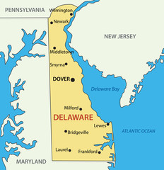
Delaware - vector map
A map of the United States with a network of lines connecting the states
Nebraska on a vintage map
Retro US city map of Oklahoma City, Oklahoma. Vintage street map.
Mongolia map city vector divided by colorful outline simplicity style. Have 2 versions, black thin line version and colorful version. Both map were on the white background.
Modern City Map - Pittsburgh Pennsylvania city of the USA with neighborhoods
Black and white map of Memphis city. Tennessee Roads
Ohio state location within United States 3d map
A large and detailed map of the State of Minnesota with all counties and county seats.
High detailed South Carolina physical map.
illinois road map
illinois road map
map of the city of Baltimore, Maryland, USA
Tennessee, USA - high detailed physical map. Vector map. Dem map.
Vector detailed map of Santa Catalina Island, California, USA. Editable map with with cities and towns, geographic sites, roads, railways. Vector EPS-10 file, trending color scheme
Memphis city map with roads and streets, United States. Vector outline illustration.
World Map and Navigation Icons
Urban vector city map of Province, USA. Rhode Island state capital
Background Fresno map, USA, white and light grey city poster. Vector map with roads and water.
Gulfport Mississippi Map, Detailed Map of Gulfport Mississippi
Empty vector map of College Station, Texas, USA
New York Map. Political map of New York with boundaries in white color.
Big city lights view from space. Planet earth globe with night realistic USA  map. America, Communication concept, Data Human Connectivity, horizontal background wallpaper
Big city lights view from space. Planet earth globe with night realistic USA map. America, Communication concept, Data Human Connectivity, horizontal background wallpaper
HDRI, environment map , Round panorama, spherical panorama, equidistant projection, panorama 360, Modern city at sunrise
Warren Pennsylvania. US street map with black and white lines.
Vector hand drawn map of Texas TX with main cities and US National Parks. US States USNPs black and white illustrated map. Full vector global color swatch different layer for ease of use
Chicago city map USA labelled black illustration
World map with highlighted India
in gray background  Republic of India location modern detailed vector map. All world countries without names. Vector template of beautiful flat grayscale map design
World map with highlighted India in gray background Republic of India location modern detailed vector map. All world countries without names. Vector template of beautiful flat grayscale map design
Animal cartoon map for Children and Kids. North America.
Large and detailed map of Miami-Dade county in Florida, USA.
High detailed Texas physical map.
ontario administrative and political map, canada
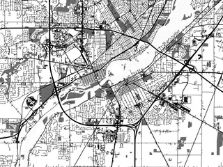
Greyscale vector city map of  Perrysburg Ohia in the United States of America with with water, fields and parks, and roads on a white background.
Greyscale vector city map of Perrysburg Ohia in the United States of America with with water, fields and parks, and roads on a white background.
Montana, USA - high detailed physical map. Vector map. Dem map.
Vancouver Island Map with Greater Vancouver, British Columbia, Canada and parts of Washington State, United States. Touristic map with key places and cities as text. Shapes are optimized.
Highly detailed vector silhouettes of US state maps, Division United States into counties, political and geographic subdivisions of a states, West North Central - Kansas, Iowa, Missouri - set 6 of 17
Illustrated map of  Colorado, USA. Travel and attractions. Souvenir print
Illustrated map of Colorado, USA. Travel and attractions. Souvenir print
Urban city map of Dallas, Texas
Colorado map
Colorado map
Birmingham Alabama Map, Detailed Map of Birmingham Alabama
Area map of San Francisco, United States
map of the city of Memphis , Mississippi, USA
Black and white map of Boston city. Massachusetts Roads
アメリカ 地図 国 アイコン
アメリカ 地図 国 アイコン
Boone Iowa. US street map with black and white lines.
World map. Highly detailed map of the world with detailed borders of all countries, cities, regions and bodies of water in blue tones.
old map
old map
Physical World Map
Physical World Map
Large and detailed map of Kern county in California, USA
High detailed Texas physical map with labeling.
New York vintage t-shirt graphic design with city map.
USA VERMONT map united states city 3d map
Buffalo map, New York, American city. Municipal administrative area map with rivers and roads, parks and railways.
new jersey map. united states map. Individual Map series of US States.
Lower and Mid Manhattan in New York detailed editable vector map with streets, geographic sites, roads. Vector EPS-10 file, trending color scheme
Set of travel posters with Washington, detailed urban street plan city map, Silhouette city skyline, vector artwork
Urban vector city map of St Louis, California , United States of America
Retro US city map of Mchenry, Illinois. Vintage street map.
Retro US city map of Allentown, Pennsylvania. Vintage street map.
Retro US city map of Green Bay, Wisconsin. Vintage street map.
Retro US city map of Dayton, Ohio. Vintage street map.
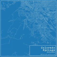
Blueprint US city map of Colorado Springs, Colorado.
Retro US city map of San Diego, California. Vintage street map.
Retro US city map of Edisto Island, South Carolina. Vintage street map.
Retro US city map of Wrightsville Beach, North Carolina. Vintage street map.
Retro US city map of Lafayette, Louisiana. Vintage street map.
Retro US city map of Croydon, Pennsylvania. Vintage street map.
Harrisburg Pennsylvania. US street map with black and white lines.
Retro US city map of Spring Hill, Florida. Vintage street map.
Retro US city map of Gurnee, Illinois. Vintage street map.
Retro US city map of Duquesne, Pennsylvania. Vintage street map.
Retro US city map of Panama City, Florida. Vintage street map.
Retro US city map of Rockford, Illinois. Vintage street map.
Retro US city map of Chippewa Falls, Wisconsin. Vintage street map.
Retro US city map of Edwardsville, Illinois. Vintage street map.
Retro US city map of Lancaster, Pennsylvania. Vintage street map.
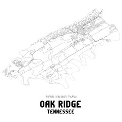
Oak Ridge Tennessee. US street map with black and white lines.
West Hollywood California. US street map with black and white lines.
Retro US city map of Nebraska City, Nebraska. Vintage street map.


Why Wallsheaven is special?

30 Days on Returns

You can return or replace any product within 30 days without reason.

Free Express Delivery

Delivery is free for all of our products, wherever you are.

Eco Water-Based Inks

Our prints are odorless, ecological, and safe for children with vivid colors from natural dyes.

Simple Installation

Installing WallsHeaven's wallpaper mural is as easy as making paper airplane.

Artist Support

By choosing our photos, you will support the artists from all over the world.