
WallsHeaven makes decorative wall murals in high quality printing

633,435 Cartography+travel+country Wall Murals - Canvas Prints - Stickers

World Map icon with pins. travel concept. 3d render illustration
map of the city of Vigo, Spain
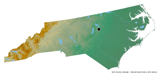
North Carolina, state of Mainland United States, on white. Relief
World Global Network Cartography Globalization with Hong Kong city background
map of India
map of India
Shikoku, political map. Region and smallest of the four main islands of Japan, northeast of Kyushu, and south of Honshu, separated by the Seto Inland Sea. Shikoku region consists of four prefectures.
Map of Washington. United States of America Washington. State maps. Vector illustration
3d Map of Turkey with color.  Türkiye country map
3d Map of Turkey with color. Türkiye country map
Australia country map made from radial halftone pattern
Stamp with map of Martinique
World map.
World map.
Togo hand-drawn sketch map
Closeup of Tokyo city, Japan on map
Canada country silhouette. Set of 3 high detailed maps. Solid black silhouette, thick black outline and thin black outline. Vector illustration isolated on white background.
Decorative tourist map of Hungary with cities, sights, architecture. Symbols of a European country for travel guides, Souvenirs, and travel websites. Print on fabric, promo. Flat Vector illustration.
Color political map of the world consisting of country names, text composition detailed vector illustration
Grey Vector world map
Abstract map of United States of America with hexagon line cells with country data icons. Editabled stroke
European countries 3d illustration, European continent with visible borders and curvature of the Earth, 3d rendering
Old vintage fantasy map
World Map isolated on white background. Flat Earth, Globe worldmap icon. Vector EPS 10
map of Africa
map of Africa
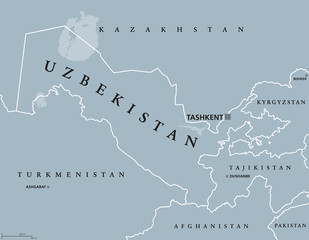
Uzbekistan political map with capital Tashkent and international borders. Republic and landlocked country in Central Asia. Gray illustration with English labeling. Vector.
Colorful USA map. United States of America regions with different colors and names for travel and geography vector illustration infographic design
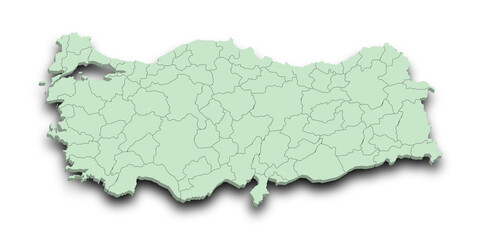
3d Map of Turkey with state and color.  Türkiye country map
3d Map of Turkey with state and color. Türkiye country map
2d stylised painting like illustration of Flying Fish Cove abstract city high quality abstract 2d ilustration.
Germany country map made from abstract halftone dot pattern
British Columbia Map
Detailed vector map of France
Colorful dark theme World Map
Map of Oregon State in gray on a white background
australia outline vector map transparent
Israel map showing country highlighted in green color with rest of Asian countries in brown
South Korea detailed administrative blue map with country flag and location on the world map. Vector illustration
Brazil illustrated map vector, South America geographic cartoon banner template with landmarks, museum, church, traditional food, Brazilian carnival, animal and flowers, design for travel poster, card
Antique world map of the 19th century and the old type
A set of Brazil maps
 Colorful vector world map. North and South America, Asia, Europe, Africa, Australia.
Colorful vector world map. North and South America, Asia, Europe, Africa, Australia.
map of Ireland
map of Ireland
South Africa, gray political map with nine provinces, with largest cities, and borders. Republic and southernmost country in Africa, with the three capitals Pretoria, Cape Town and Bloemfontein.
Map of Australia vector Illustration
3d Map of Turkey with color.  Türkiye country map
3d Map of Turkey with color. Türkiye country map
Urban vector city map of Phoenix, Arizona, USA
Travel World Map With GPS Pins
Watercolor map Africa pink blue
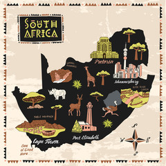
Illustrated map of South Africa. Set of national symbols and elements of architecture and culture
Icon set of geography.
Map of the area. Cartoon city, mountains river and village. Forest hills and sea. Hand drawn sketch vector yellow and black line outline contour.
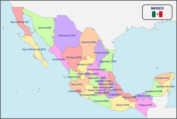
Political Map of Mexico with Names
Businessman using a smartphone with a Network over a connected world map - 3d render
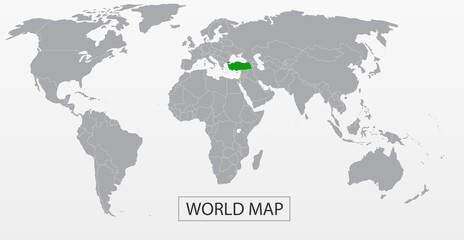
Political Vector Map of the world with clear borders with highlighted Turkey. Each country is isolated and selectable. Suitable for reports, statistics, infographics, templates. Silhouette backd
Netherlands detailed map and flag. Netherlands on world map.
World map, detailed country map of the world, blue template for annual report format, business, infographic, global tourism - vector
Political World Map vector illustration with different tones of blue for each country and country names in french. Editable and clearly labeled layers.
Maryland Map Black | State Border | United States | US America | Transparent Isolated | Variations
Location marking with a pin on a map with routes. Find your way. Adventure, discovery, navigation, communication, logistics, geography, transport and travel theme concept background.
outline drawing of brazil map.
map of North America
Solomon Islands political map with capital Honiara on Guadalcanal. Sovereign country consisting of six major islands in Oceania between Papua New Guinea and Vanuatu. English labeling. Illustration.
Travel Concept
Travel Concept
3d Map of Turkey with state and color.  Türkiye country map
3d Map of Turkey with state and color. Türkiye country map
3d Map of Turkey with color.  Türkiye country map
3d Map of Turkey with color. Türkiye country map
3d Map of Turkey with color.  Türkiye country map
3d Map of Turkey with color. Türkiye country map
3d Map of Turkey with color.  Türkiye country map
3d Map of Turkey with color. Türkiye country map
3d Map of Turkey with state and color.  Türkiye country map
3d Map of Turkey with state and color. Türkiye country map
3d Map of Turkey with state and color.  Türkiye country map
3d Map of Turkey with state and color. Türkiye country map
3d Map of Turkey with color.  Türkiye country map
3d Map of Turkey with color. Türkiye country map
3d Map of Turkey with color.  Türkiye country map
3d Map of Turkey with color. Türkiye country map
3d Map of Turkey with state and color.  Türkiye country map
3d Map of Turkey with state and color. Türkiye country map
3d Map of Turkey with state and color.  Türkiye country map
3d Map of Turkey with state and color. Türkiye country map
3d Map of Turkey with color.  Türkiye country map
3d Map of Turkey with color. Türkiye country map
3d Map of Turkey with state and color.  Türkiye country map
3d Map of Turkey with state and color. Türkiye country map
3d Map of Turkey with color.  Türkiye country map
3d Map of Turkey with color. Türkiye country map
3d Map of Turkey with color.  Türkiye country map
3d Map of Turkey with color. Türkiye country map
3d Map of Turkey with state and color.  Türkiye country map
3d Map of Turkey with state and color. Türkiye country map
3d Map of Turkey with state and color.  Türkiye country map
3d Map of Turkey with state and color. Türkiye country map
3d Map of Turkey with color.  Türkiye country map
3d Map of Turkey with color. Türkiye country map
3d Map of Turkey with color.  Türkiye country map
3d Map of Turkey with color. Türkiye country map
3d Map of Turkey with state and color.  Türkiye country map
3d Map of Turkey with state and color. Türkiye country map
3d Map of Turkey with state and color.  Türkiye country map
3d Map of Turkey with state and color. Türkiye country map
3d Map of Turkey with state and color.  Türkiye country map
3d Map of Turkey with state and color. Türkiye country map


Why Wallsheaven is special?

30 Days on Returns

You can return or replace any product within 30 days without reason.

Free Express Delivery

Delivery is free for all of our products, wherever you are.

Eco Water-Based Inks

Our prints are odorless, ecological, and safe for children with vivid colors from natural dyes.

Simple Installation

Installing WallsHeaven's wallpaper mural is as easy as making paper airplane.

Artist Support

By choosing our photos, you will support the artists from all over the world.